Search All Items
- Filters:
- Type
- Still Image 4044
- Image 3895
- Text 436
- Text 51
- Image of the California Census from the records of the office of the California Secretary of State 1
- Language
- English 7939
- Spanish 494
- ENGLISH 4
- English 2
- census_013 1
- contra_costa_schedule_1_volume_1 1
Search Results 3571 to 3580 of 8605
-
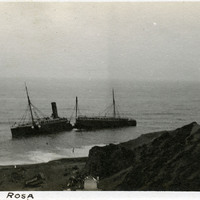
Caption: "S.S. Santa Rosa." Wreck of the S.S. Santa Rosa off Point Arguello in Santa Barbara County. The steamship ran aground on July 6, 1911. Unable to break free, the turbulent waters eventually cracked the ship in half. All two hundred passengers got to shore alive, the only fatalities coming when four sailors were accidentally thrown out of a lifeboat by rough seas while attempting to establish a land line to stabilize the wreck.
Date: 1911
-
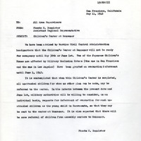
Correspondence from Phoebe H. Bannister to All Area Supervisors regarding evacuation of children in institutions and the Children's Center at Manzanar
Date: May 11, 1942
-
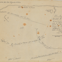
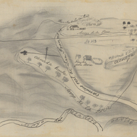
Hand-drawn sketch map of San Pedro y San Pablo boundaries. Volume 1, page 442.
Date: 1839
-
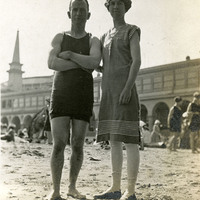
Caption: "Santa Cruz Beach," c. 1915, shows William and Grace McCarthy wearing swim suits and standing on the beach at Santa Cruz.
Date: 1915
-
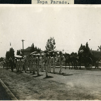
Caption: "Napa Parade," c. 1907. A view of a parade procession on a dirt road in Napa.
Date: 1907
-
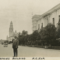
Caption: "Varied Industries Building P.C. Exp." William McCarthy is seen standing near the Varied Industries Building, with the California Building in the background, at the Panama-California Exposition in Balboa Park, San Diego. See also 96-07-08-alb01-157.
Date: 1915
-
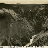
Caption: "Grand View - Yellowstone Grand Canyon," c. 1935.
Date: 1935
-
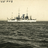
Caption: "The Massachusetts," Ship designed for coastal defense. Unidentified location, undated.
Date: undated
-
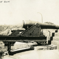
Caption: "Old Time Gun." at unidentified location, c. 1905.
Date: 1905