Search All Items
- Filters:
- Language
- English 7958
- Spanish 495
- ENGLISH 4
- English 2
- census_013 1
- contra_costa_schedule_1_volume_1 1
- Type
- Still Image 4047
- Image 3895
- Text 451
- Text 54
- Textual 2
- Image of the California Census from the records of the office of the California Secretary of State 1
Search Results 6421 to 6430 of 8628
-
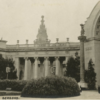
Caption: "Court of Four Seasons," at the Panama-Pacific International Exposition. See also 96-07-08-alb01-078
Date: 1915
-
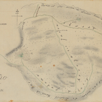
Hand-drawn sketch map of Rincon de la Ballena boundaries. Volume 1, page 538.
Date: 1839
-
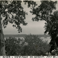
Caption: "Potomac River, View from Mt. Vernon. July 22, 1934." Trees obscure much of the photograph, but the Potomac River can be glimpsed in the distance.
Date: 7/22/1934
-
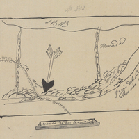
Hand-drawn sketch map of Cañadas, or San Julian boundaries. Volume 1, page 356.
Date: 1837
-
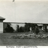
Caption: "Sutters [sic] Fort - Sacramento," c. 1920, shows a gun tower at Sutter's Fort, and a gate bracketed by two cannons. John Sutter established the fort in 1839, calling it New Helvetia. After the discovery of gold at one of Sutter's mills (at Coloma, on the American River), almost all of the fort's inhabitants left for the gold fields in the foothills. The fort deteriorated until being restored from 1891-1893. The Native Sons of the Golden West were influential in the restoration. The fort is now the site of a State Historic Park. See also 96-07-08-alb05-117 and 118.
Date: 1920
-
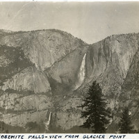
Caption: "Yosemite Falls - View From Glacier Point," c. 1917. Yosemite Falls in the distance, as seen from Glacier Point. The highest waterfall in Yosemite National Park, Yosemite Falls is made up of two successive cascades falling a total of 2,425 feet from the top of the Upper Fall to the base of the Lower Fall. The Upper Fall alone is 1,430 feet high, and is one of the top twenty highest waterfalls in the world.
Date: 1917
-
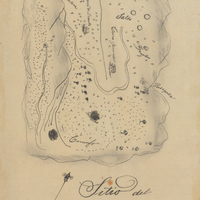
Hand-drawn sketch map of Conejo Rancho, or Nuesta Senora de Altagracia boundaries. Volume 1, page 324.
Date: 1834
-
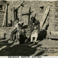
Caption: "Puablo [sic] Indian Mother and Child, Arizona Grand Canyon," c. 1935, shows a Pueblo Indian mother with three children.
Date: 1935
-
Caption: "Miami Beach -- Florida, June 30." Crowded beach scene with palm trees at the right and the water in the distance to the left.
Date: 6/30/1934
-
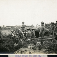
Caption: "Field Piece in Action." Unidentified location, c. 1905-1915. Shows a crew of men operating a 3" field gun, a heavy artillery gun set onto a carriage for mobile use. The U.S. military used these guns between 1905 and 1919, gradually phasing them out of use during the 1920s in favor of more modern weapons.
Date: 1915