Search All Items
- Filters:
- Language
- English 7958
- Spanish 495
- ENGLISH 4
- English 2
- census_013 1
- contra_costa_schedule_1_volume_1 1
- Type
- Still Image 4047
- Image 3895
- Text 451
- Text 54
- Textual 2
- Image of the California Census from the records of the office of the California Secretary of State 1
Search Results 6841 to 6850 of 8628
-
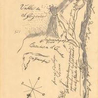
Hand-drawn sketch map of Land-San Jacinto y San Gorgonio or Yuciapa boundaries. Volume 2, page 180.
Date: 1843
-
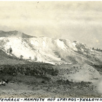
Caption: "Jupiter Terrace - Mammoth Hot Springs - Yellowstone Park," c. 1923. Jupiter Terrace is part of the Lower Terraces of Mammoth Hot Springs. A group of riding horses is seen at lower left, and a road flanks what appear to be observation points at the bottom right.
Date: 1923
-
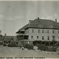
Caption: "Summit Hotel on the Truckee Highway." Hotel, probably in the vicinity of Donner Lake and what is now Interstate 80.
Date: 1927
-
Correspondence from Earl Warren (by Warren Olney) to Harry B. Riley regarding resident nationals of enemy countries in respect to the Trading with the Enemy Act of 1917
Date: January 8, 1942
-
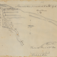
Hand-drawn sketch map of Guaspita, or Sausal Redondo or Santa Elena boundaries. Volume 1, page 190.
Date: 1836
-
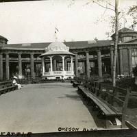
Caption: "A.Y.P.E. Seattle Oregon Bldg." View of Oregon Building and bandstand, part of the Alaska-Yukon-Pacific Exposition. Held in Seattle to celebrate the development of the Pacific Northwest, the fair attracted 3.7 million visitors over the course of its run from June to October 1909. Although most of the fair's buildings have since been destroyed, several of them now serve as part of the University of Washington campus.
Date: 1909