Search All Items
- Filters:
- Language
- English 7958
- Spanish 495
- ENGLISH 4
- English 2
- census_013 1
- contra_costa_schedule_1_volume_1 1
- Type
- Still Image 4047
- Image 3895
- Text 451
- Text 54
- Textual 2
- Image of the California Census from the records of the office of the California Secretary of State 1
Search Results 7071 to 7080 of 8628
-
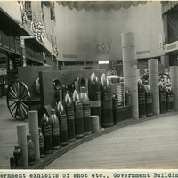
Caption: "Government exhibits of shot etc., Government Building." Exhibit of various types of heavy ordnance shells, including armor piercing shells as well as torpedoes. The exhibit was located in the Government Building of the Lewis and Clark Centennial Exposition, held in Portland, Oregon from June 1st to October 15th, 1905. It celebrated the one-hundred year anniversary of the exploratory expedition of the Louisiana Purchase and what became the northwestern part of the United States, led by Meriwether Lewis and William Clark. Some 1.6 million people visited the fair, viewing exhibits from twenty-one countries. See also 96-07-08-alb05-206.
Date: 1905
-
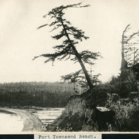
Caption: "Port Townsend Beach.," c. 1908-1912. Tree on edge of cliff, with beach in the distance.
Date: 1908
-
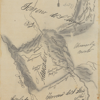
Hand-drawn sketch map of Asuncion and Atascadero boundaries. Volume 1, page 716.
Date: 1839
-
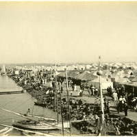
No Caption: c. 1910. View of rows of tents and sheds thatched in palm fronds along the coast near Coronado Hotel, with people strolling along the roadways. Established in 1900 for travelers who could not afford to stay in the resort hotel, the Coronado Tent City consisted of a grid of streets lined with furnished tents, near the sea shore. It also featured restaurants, a library, soda fountain, theater, bandstand, and other recreational facilities. See also 96-07-08-alb05-202 and 96-07-08-alb08-210.
Date: 1910
-
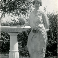
No caption. Grace McCarthy poses next to a bird bath in a garden, c. 1925.
Date: 1925
-
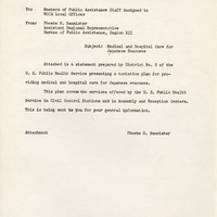
Correspondence from Phoebe H. Bannister to Members of Public Assistance Staff Assigned to WCCA Local Office regarding statement by U.S. Public Health Service regarding medical care; see F3729_89_001b-F3729_89_001f for statement
Date: April 25, 1942
-
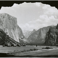
No Caption: In this 1935 photograph, the opening of the Wawona highway tunnel frames the Yosemite Valley with El Capitan (the Captain) on the left, Bridalveil Falls on the right, and Half Dome in the distance.
Date: 1935
-
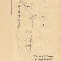
Hand-drawn sketch map of Potreros de la Sierra del Agua Caliente, or Poteros de San Juan Capistrano boundaries. Volume 2, page 120.
Date: 1845
-
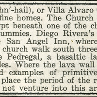
No Caption: A section from an informational tourist brochure describing San Angel, or Villa Alvaro Obregon, a municipality of Mexico City.
Date: 1938
-
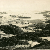
Caption: "San Francisco Bay From Mt Tamalpais," c. 1907. A bird's eye view of the bay from atop Mount Tamalpais.
Date: 1907