Search All Items
- Filters:
- Language
- English 7958
- Spanish 495
- ENGLISH 4
- English 2
- census_013 1
- contra_costa_schedule_1_volume_1 1
- Type
- Still Image 4047
- Image 3895
- Text 451
- Text 54
- Textual 2
- Image of the California Census from the records of the office of the California Secretary of State 1
Search Results 7531 to 7540 of 8628
-
No Caption: See also 96-07-08-alb08-024 with caption: Ordnance Avenue, Fort Casey," Washington, c. 1908. Fort Casey was part of the "triangle of fire," three coastal defense fortifications (Fort Casey, Fort Worden, and Fort Flagler) guarding the entrance to Puget Sound. Construction began on the fort in 1897, and the U.S. Army used the facility until the 1950s, when the fort was decommissioned. The area is now a state park.
Date: 1908
-
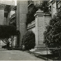
No Caption: The colonnades at the Palace of the Fine Arts at the Panama-Pacific International Exposition.
Date: 1915
-
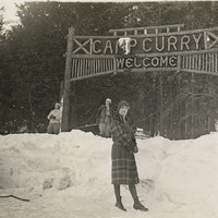
No Caption: Grace McCarthy standing in the snow at the entrance to Camp Curry campground in Yosemite National Park, c. 1932.
Date: 1932
-
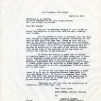
Correspondence from Earl Warren (by Sherrill Halbert) to A. H. Brazil regarding use of Alien Land Law maps for general defense work
Date: March 20, 1942
-
Hand-drawn sketch map of Potrero Nuevo or Potrero de San Francisco boundaries. Volume 2, page 54.
Date: 1844