Search All Items
- Filters:
- Language
- English 7958
- Spanish 495
- ENGLISH 4
- English 2
- census_013 1
- contra_costa_schedule_1_volume_1 1
- Type
- Still Image 4047
- Image 3895
- Text 451
- Text 54
- Textual 2
- Image of the California Census from the records of the office of the California Secretary of State 1
Search Results 841 to 850 of 8628
-
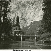
Caption: "Sentinel Hotel," c. 1917. The Sentinel Hotel at Yosemite Village, with a granite cliff in the background and the Merced River in the foreground. Construction of the hotel began in 1876, and at the turn of the century it was the only hotel operating in the valley. Increased attendance as the twentieth century progressed resulted in the construction of other tourist areas such as Curry Village, and the Sentinel gradually became obsolete. The Sentinel and the complex of buildings that had grown up around it were torn down in the late 1930s.
Date: 1917
-
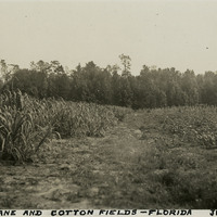
Caption: "Sugar Cane and Cotton Fields -- Florida, June 23, 34." A sugar cane field (at left) borders a cotton field (at right) in this photograph.
Date: 6/23/1934
-
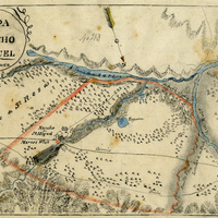
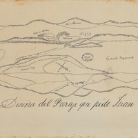
Hand-drawn sketch map of San Miguel or Chisino boundaries. Volume 1, page 578.
Date: 1840
-
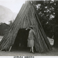
Caption: "Indian Wigwam," c. 1917. Grace McCarthy poses at the entrance to what William McCarthy labeled a "wigwam," a dwelling of the Ahwahnechee people. The Ahwahnechee (a Native American tribe who traditionally occupied the Yosemite Valley) called the dwellings o-chum. Pine branches were arranged in a tee-pee-like shape and then covered with layered slabs of cedar bark.
Date: 1917
-
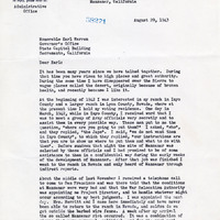
Correspondence from Ralph P. Merritt to Earl Warren regarding riots at Manzanar, administration of Manzanar, movement of certain Japanese from Manzanar to Tule Lake, citizenship, and loyalty
Date: August 29, 1943
-
List of bulletins and circular letters relating to procedures published and distributed to counties
Date: Undated
-
Hand-drawn sketch map of Cañada de Raimundo boundaries. Volume 1, page 592.
Date: 1839