Search All Items
- Filters:
- Type
- Still Image 4044
- Image 3895
- Text 436
- Text 50
- Image of the California Census from the records of the office of the California Secretary of State 1
- Language
- English 7938
- Spanish 494
- ENGLISH 4
- English 2
- census_013 1
- contra_costa_schedule_1_volume_1 1
Search Results 2851 to 2860 of 8604
-
Correspondence from Azile H. Aaron to Martha A. Chickering regarding a change in policy relating to transportation of individuals in hospitals or institutions
Date: August 18, 1942
-
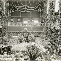
No Caption: A view of the interior of the state of Oregon building at the Panama-Pacific International Exposition.
Date: 1915
-
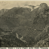
Caption: "Zion National Park - view from Zion Park Tunnel," c. 1935.
Date: 1935
-
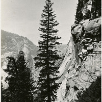
Caption: " Rugged Cliffs," c. 1917. View of a sheer cliff face with rocky, timbered mountains beyond.
Date: 1917
-
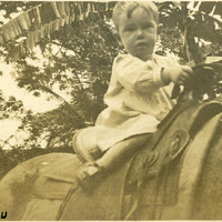
Caption: "Honolulu," c. 1906. Unidentified toddler posed on the back of a horse.
Date: 1906
-
Correspondence from E. J. Clark to Lt. General Joseph H. Swing regarding records pertaining to Japanese examined in 1942
Date: October 9, 1951
-
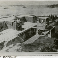
Caption: "Coast Defense." Photograph of part of a print from the Illustrated London News, titled "A Modern Method of Coast Defense: The Arrangement of an Up-To-Date Battery." See also 96-07-08-alb08-230.
Date: 1910-09-03
-
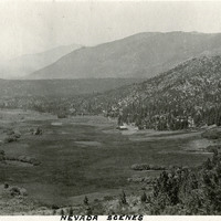
Caption: "Nevada Scenes." Valley surrounded by mountains.
Date: 1927
-
Caption: "Roman Plunge -- Del Monte.," c. 1920. The Hotel Del Monte, near Monterey, featured a "roman plunge," a swimming pool built in 1915.
Date: 1920
-
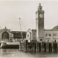
No Caption: A view of buildings and ferry at Grand Trunk Pacific pier along the Seattle waterfront, c. 1935.
Date: 1935