Search All Items
- Filters:
- Type
- Still Image 4044
- Image 3895
- Text 436
- Text 51
- Image of the California Census from the records of the office of the California Secretary of State 1
- Language
- English 7939
- Spanish 494
- ENGLISH 4
- English 2
- census_013 1
- contra_costa_schedule_1_volume_1 1
Search Results 3541 to 3550 of 8605
-
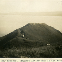
Caption: "Battery Spencer. Highest 12" Battery in the World." With construction begun in 1893, Battery Spencer, located at Fort Baker in Marin County on the north side of the Golden Gate Bridge, was one of the main protection points for the San Francisco harbor from 1897 until it was deactivated in 1942. It was named for Major General Joseph Spencer of the Continental Army during the Revolutionary War.
Date: 1908
-
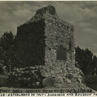
Caption: "Fort Hall Indian Reservation, Idaho. 500,000 acres - established in 1867 - Shoshone and Bannock Tribes," c. 1935.
Date: 1935
-
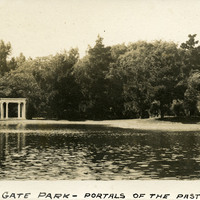
Caption: "Golden Gate Park -- Portals of the Past," c. 1910. A monument in Golden Gate Park in San Francisco, on the shores of Lloyd Lake, consisting of a white marble archway and columns. The archway was originally part of the Nob Hill mansion belonging to railroad tycoon Alban Towne. The mansion was destroyed in the 1906 San Francisco earthquake and fire, but the entryway still stood. It was moved to the shore of Lloyd Lake in 1909, as a memorial to the pre-1906 city.
Date: 1910
-
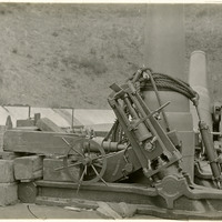
No Caption: undated. Photograph shows the base of what appears to be a 12" mortar, and part of its carriage.
Date: Undated
-
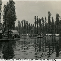
Caption: "Xochimilco - Floating Gardens - the Mexican Venice."
Date: 1938
-
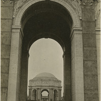
Caption: "Western Arch," at the Panama-Pacific International Exposition. See also 96-07-08-alb01-097.
Date: 1915
-
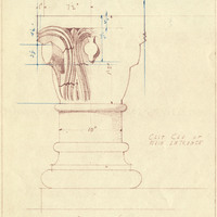
Caption: "Explanatory Detail. Kitchen & Dining Room - Pac Colony State Narcotic Hosp." Pacific State Hospital. Design and drawing by Alfred Eichler, 1940 (May). Built. Project for Department of Mental Hygiene - Hospitals. The hospital was initially named Pacific Colony (1927-1953), followed by Pacific State Hospital (1953-1979); Frank D. Lanterman State Hospital and Developmental Center; and finally Lanterman Developmental Center, which closed in 2015.
Date: 1940
-
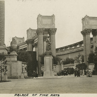
Caption: "Palace of Fine Arts," with several visitors viewing the statuary at the Panama-Pacific International Exposition.
Date: 1915