Search All Items
- Filters:
- Type
- Image 1263
- Still Image 122
- Text 93
- Text 19
- Language
- English 1450
- Spanish 48
- ENGLISH 2
- English 1
- census_013 1
Search Results 21 to 30 of 1517
-
This item has no description.
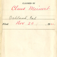
Date: Expediente number 389
-
Hand-drawn sketch map of Valle de las Palmas boundaries. Volume 2, page 144.
Date: 1845
-
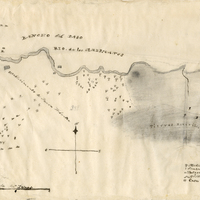
Hand-drawn sketch map of Rio de los Americanos boundaries. Volume 2, page 73.
Date: 1844
-
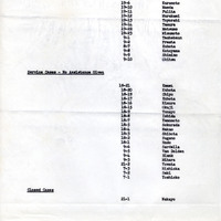
Report on number of cases; Sections: Active Cases; Service Cases; Closed Cases"; for similar report see F3729_73_001
Date: March 10, 1942
-
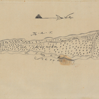
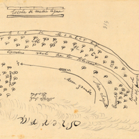
Hand-drawn sketch map of San Jose y Sur Chiquita boundaries. Volume 1, page 528.
Date: 1839
-
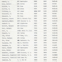
List of Japanese holders of commercial fishing licences, arranged alphabetically by last name
Date: 1941-1942
-
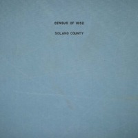
The Census of 1852 collection includes enumerations of California's 32 counties, arranged into 126 volumes. Schedule I enumerated the county's inhabitants, while schedule II enurmerated economic production. Many pages of this volume are damaged.
Date: 1852
-
Hand-drawn sketch map of Ojo de Agua del Encinal boundaries. Volume 2, page 176.
Date: 1839