Search All Items
- Filters:
- Type
- Image 1263
- Still Image 122
- Text 93
- Text 19
- Language
- English 1450
- Spanish 48
- ENGLISH 2
- English 1
- census_013 1
Search Results 31 to 40 of 1517
-
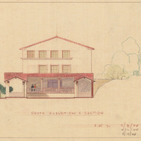
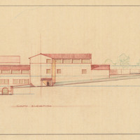
Caption: "South Elevation and Section." Color drawing of postwar building, California School for the Deaf at Berkeley. Design and drawing by Alfred Eichler, 1944; built in 1946. Project for Department of Education.
Date: 1944
-
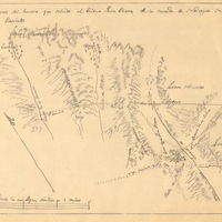
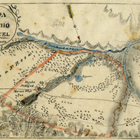
Hand-drawn sketch map of San Diego or San Deiguito boundaries. Volume 2, page 187.
Date: 1843
-
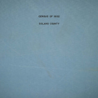
The Census of 1852 collection includes enumerations of California's 32 counties, arranged into 126 volumes. Schedule I enumerated the county's inhabitants, while schedule II enurmerated economic production. Many pages of this volume are damaged.
Date: 1852
-
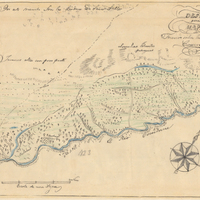
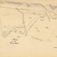
Hand-drawn sketch map of Rio de las Consumnes al Norte or Omachumnes boundaries. Volume 2, page 109.
Date: 1843
-
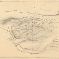
Hand-drawn sketch map of San Miguel or Chisino boundaries. Volume 1, page 578.
Date: 1840
-
The Census of 1852 collection includes enumerations of California's 32 counties, arranged into 126 volumes. Schedule I enumerated the county's inhabitants, while schedule II enurmerated economic production. Many pages of this volume are damaged.
Date: 1852
-
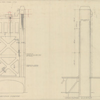
Final design drawing of transverse and longitudinal elevations for tower, M Street Bridge, by Alfred Eichler. The Tower Bridge replaced the M Street Bridge, which was removed in 1935. Project for Department of Public Works - Highways - Bridge Department.
Date: 1934
-
Caption: "Kindergarten Unit. South Elevation." Color drawing of California School for the Deaf at Berkeley. Design and drawing by Alfred Eichler, 1944; built in 1946. Project for Department of Education.
Date: 1944