Search All Items
- Filters:
- Type
- Image 2673
- Still Image 417
- Text 261
- Text 19
- Language
- English 3086
- Spanish 287
- ENGLISH 3
- English 1
- census_013 1
Search Results 71 to 80 of 3402
-
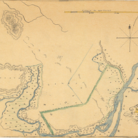
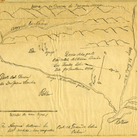
Hand-drawn sketch map of Bidwell's Rancho boundaries. Volume 2, page 72.
Date: 1844
-
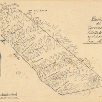
Hand-drawn sketch map of Descanso at San Miguel boundaries. Volume 2, page 159.
Date: 1845
-
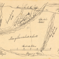
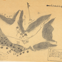
Hand-drawn sketch map of Blosa del Chamizal boundaries. Volume 2, page 174.
Date: 1837
-
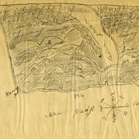
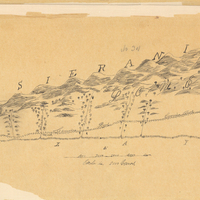
Hand-drawn sketch map of Agua Puerca y Las Trancas boundaries. Volume 2, page 18.
Date: 1843
-
Informational memo from W. K. Shaughnessy to All Control Station Managers regarding arrangements for banking and shipment of household goods for relocated Japanese
Date: April 22, 1942
-
Hand-drawn sketch map of Valle de las Palmas boundaries. Volume 2, page 144.
Date: 1845