Search All Items
- Filters:
- Type
- Image 2673
- Still Image 417
- Text 261
- Text 19
- Language
- English 3086
- Spanish 287
- ENGLISH 3
- English 1
- census_013 1
Search Results 81 to 90 of 3402
-
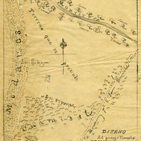
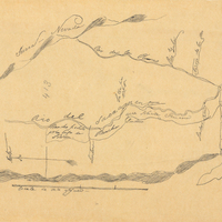
Hand-drawn sketch map of Land- Monterey county, or Lomas del Carmelo or Meadows Tract boundaries. Volume 2, page 29.
Date: 1833
-
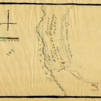
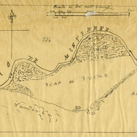
Hand-drawn sketch map of Cañada de San Geronimo or Rancho de San Geronimo boundaries. Volume 2, page 36.
Date: 1839
-
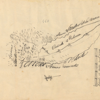
Hand-drawn sketch map of Cañada de Palomea or Guejeto y Cañada de Palomea boundaries. Volume 2, page 140.
Date: 1845
-
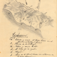
Hand-drawn sketch map of Cañada de los Osos y Pecho y Islae boundaries. Volume 2, page 11.
Date: 1842
-
Hand-drawn sketch map of Jimeno, or Salsipuedes, or Santa Paula y Saticoy boundaries. Volume 2, page 97.
Date: 1844
-
Hand-drawn sketch map of Land- Monterey county, or Lomas del Carmelo or Meadows Tract boundaries. Volume 2, page 28.
Date: 1833
-
Hand-drawn sketch map of Cañada de los Osos y Pecho y Islae boundaries. Volume 2, page 142.
Date: 1843
-
Hand-drawn sketch map of Cañada de los Osos y Pecho y Islae boundaries. Volume 2, page 183.
Date: 1843
-
Caption: "Spanish Type Home -- Key West. July 2, 1934." View of a multi-story residence in Key West. Much of the building is obscured by surrounding vegetation.
Date: 7/2/1934