Search All Items
- Filters:
- Type
- Image 2673
- Still Image 417
- Text 261
- Text 19
- Language
- English 3086
- Spanish 287
- ENGLISH 3
- English 1
- census_013 1
Search Results 111 to 120 of 3402
-
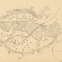
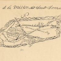
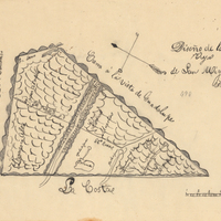
Hand-drawn sketch map of Land- Mission San Buenaventura boundaries. Volume 2, page 138.
Date: 1845
-
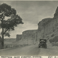
Caption: "Rocky Mountains Near Evanston, Wyoming. Oct. 2, 1934." Automobile parked along a narrow road, flanked on one side by brush and trees in a field, and on the other by steep rocky bluffs.
Date: 10/2/1934
-
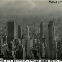
Caption: "New York Sky Scrapers. Empire State bldg. on Right. Aug. 2, 1934." Bird's eye view of New York City showing a forest of sky scrapers, the tallest being the Empire State Building on the right side of the photograph.
Date: 8/2/1934
-
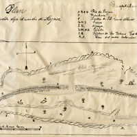
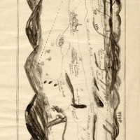
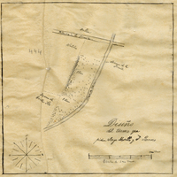
Hand-drawn sketch map of Mission Vieja de San Rafael boundaries. Volume 2, page 160.
Date: 1845
-
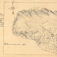
Hand-drawn sketch map of Portrero de Felipe Lugo boundaries. Volume 2, page 126.
Date: 1845