Search All Items
- Filters:
- Type
- Image 2673
- Still Image 417
- Text 261
- Text 19
- Language
- English 3086
- Spanish 287
- ENGLISH 3
- English 1
- census_013 1
Search Results 131 to 140 of 3402
-
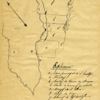
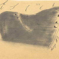
Hand-drawn sketch map of Lot- Mission- San Luis Obispo boundaries. Volume 2, page 88.
Date: 1843
-
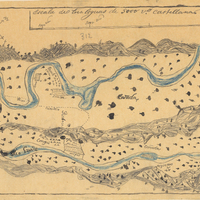
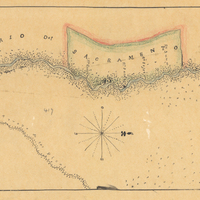
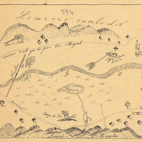
Hand-drawn sketch map of Boca de Santa Monica boundaries. Volume 2, page 24.
Date: 1838
-
Hand-drawn sketch map of Larkin's Rancho or Children's Rancho boundaries. Volume 2, page 101.
Date: 1844
-
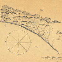
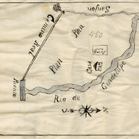
Hand-drawn sketch map of Real de las Aguilas boundaries. Volume 2, page 62.
Date: 1843
-
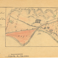
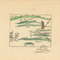
Hand-drawn sketch map of Potrero de los Cerritos boundaries. Volume 2, page 51.
Date: 1840
-
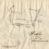
Hand-drawn sketch map of Santa Iasabel boundaries. Volume 2, page 81.
Date: 1843