Search All Items
- Filters:
- Type
- Image 2673
- Still Image 417
- Text 261
- Text 19
- Language
- English 3086
- Spanish 287
- ENGLISH 3
- English 1
- census_013 1
Search Results 121 to 130 of 3402
-
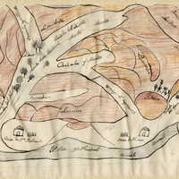
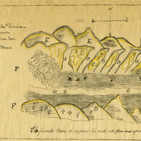
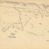
Hand-drawn sketch map of Lihuaytos or Putos or Ulattis boundaries. Volume 2, page 110.
Date: 1843
-
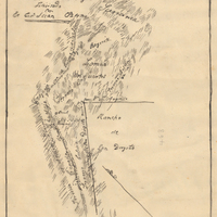
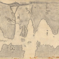
Hand-drawn sketch map of Land at Buenaventura boundaries. Volume 2, page 134.
Date: 1845
-
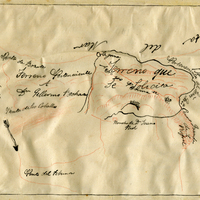
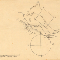
Hand-drawn sketch map of San Diego or San Deiguito boundaries. Volume 2, page 136.
Date: 1845
-
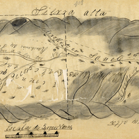
Hand-drawn sketch map of San Clemente or Tamalpais boundaries. Volume 2, page 124.
Date: 1845
-
Hand-drawn sketch map of San Clemente or Tamalpais boundaries. Volume 2, page 122.
Date: 1845
-
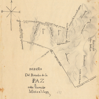
Hand-drawn sketch map of Mission Vieja or La Paz boundaries. Volume 2, page 119.
Date: 1843
-
Hand-drawn sketch map of San Diego or San Deiguito boundaries. Volume 2, page 186.
Date: 1843