Search All Items
- Filters:
- Type
- Image 2673
- Still Image 417
- Text 261
- Text 19
- Language
- English 3086
- Spanish 287
- ENGLISH 3
- English 1
- census_013 1
Search Results 141 to 150 of 3402
-
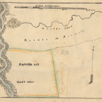
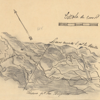
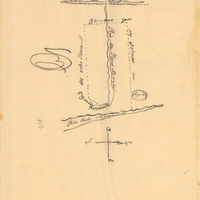
Hand-drawn sketch map of Rancho del Paso boundaries. Volume 2, page 85.
Date: 1844
-
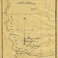
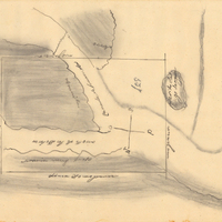
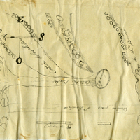
Hand-drawn sketch map of Potrero de los Cerritos boundaries. Volume 2, page 52.
Date: 1840
-
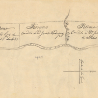
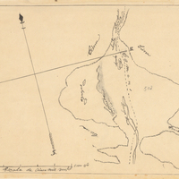
Hand-drawn sketch map of Huefano Or Huer-huero boundaries. Volume 2, page 169.
Date: 1846
-
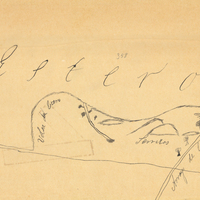
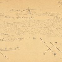
Hand-drawn sketch map of Canada de la Berrenda boundaries. Volume 2, page 196.
Date: 1846
-
Hand-drawn sketch map of Guesesosi or Jesus Maria boundaries. Volume 2, page 178.
Date: 1842
-
Hand-drawn sketch map of Salinas y Visitacion boundaries. Volume 1, Page 2.
Date: 1834