Search All Items
- Filters:
- Type
- Image 2673
- Still Image 417
- Text 261
- Text 19
- Language
- English 3086
- Spanish 287
- ENGLISH 3
- English 1
- census_013 1
Search Results 181 to 190 of 3402
-
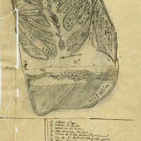
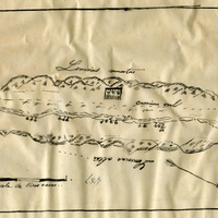
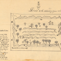
Hand-drawn sketch map of Cañada Larga o Verde boundaries. Volume 2, page 5.
Date: 1840
-
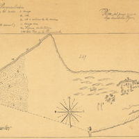
Hand-drawn sketch map of Cañada de Capay boundaries. Volume 2, page 96.
Date: 1844
-
Hand-drawn sketch map of Pleyto, or San Bartolome boundaries. Volume 2, page 133.
Date: 1845
-
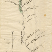
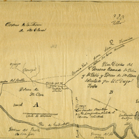
Hand-drawn sketch map of Potrero de Santa Clara boundaries. Volume 2, page 45.
Date: 1844
-
Hand-drawn sketch map of Mission vieja de San Gabriel boundaries. Volume 2, page 121.
Date: 1845
-
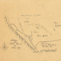
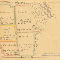
Hand-drawn sketch map of Alamos y Agua Caliente boundaries. Volume 2, page 199.
Date: 1845