Search All Items
- Filters:
- Type
- Image 2673
- Still Image 417
- Text 261
- Text 19
- Language
- English 3086
- Spanish 287
- ENGLISH 3
- English 1
- census_013 1
Search Results 201 to 210 of 3402
-
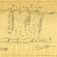
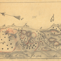
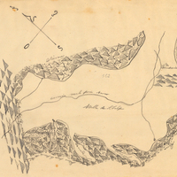
Hand-drawn sketch map of Najoque or Nojoguez boundaries. Volume 2, page 79.
Date: 1842
-
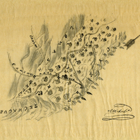
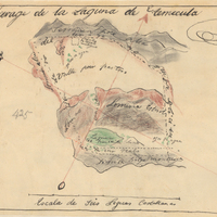
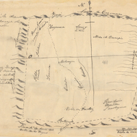
Hand-drawn sketch map of Laguna de Temacula boundaries. Volume 2, page 111.
Date: 1844
-
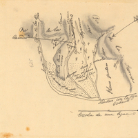
Hand-drawn sketch map of Valle de la Trinidad boundaries. Volume 2, page 194.
Date: 1846
-
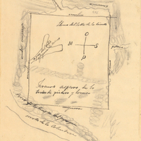
Hand-drawn sketch map of Valle de San Felipe boundaries. Volume 2, page 200
Date: 1846
-
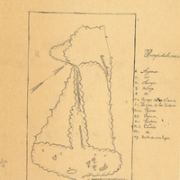
Hand-drawn sketch map of Sierra de Cuyamaca boundaries. Volume 2, page 137.
Date: 1845