Search All Items
- Filters:
- Type
- Image 2673
- Still Image 417
- Text 261
- Text 19
- Language
- English 3086
- Spanish 287
- ENGLISH 3
- English 1
- census_013 1
Search Results 221 to 230 of 3402
-
Hand-drawn sketch map of Santa Monica Boca, or San Vicente y Santa Monica boundaries. Volume 2, page 49.
Date: 1836
-
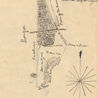
Hand-drawn sketch map of Tajui, Agua Caliente or Valle de San Jose boundaries. Volume 2, page 89.
Date: 1844
-
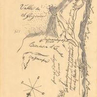
Hand-drawn sketch map of Land-San Jacinto y San Gorgonio or Yuciapa boundaries. Volume 2, page 180.
Date: 1843
-
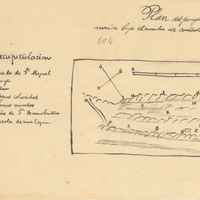
Hand-drawn sketch map of Mission Vieja de la Purisima or Valle de los Palmas boundaries. Volume 2, page 149.
Date: 1845
-
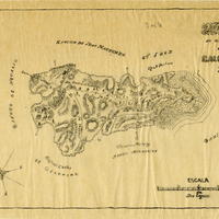
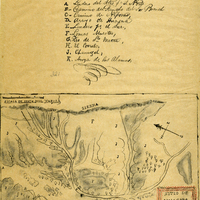
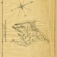
Hand-drawn sketch map of Gallinas y Santa Margarita or San Pedro boundaries. Volume 2, page 40.
Date: 1844
-
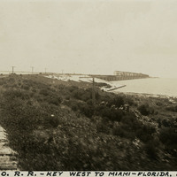
Caption: "P. and O. R.R. -- Key West to Miami -- Florida. July 2, 1934." View of railroad tracks carried on a berm in the foreground and on a trestle over water in the distance. This is likely part of the Overseas Railroad, an extension of the Florida East Coast Railway, built to connect Key West with the Florida mainland.
Date: 7/2/1934
-
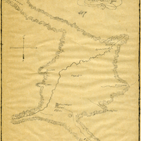
Hand-drawn sketch map of Huasna or Ex-Mission of San Luis Obispo boundaries. Volume 2, page 15.
Date: 1843
-
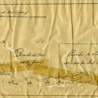
Hand-drawn sketch map of Rancho Del San Juan or San Juan boundaries. Volume 2, page 100.
Date: 1844
-
Hand-drawn sketch map of Cañada de San Miguelito or Cañada del Diablo boundaries. Volume 2, page 167.
Date: 1845
-
Hand-drawn sketch map of Gallinas y Santa Margarita or San Pedro boundaries. Volume 2, page 39.
Date: 1844