Search All Items
- Filters:
- Type
- Image 2673
- Still Image 417
- Text 261
- Text 19
- Language
- English 3086
- Spanish 287
- ENGLISH 3
- English 1
- census_013 1
Search Results 211 to 220 of 3402
-
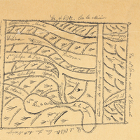
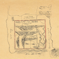
Hand-drawn sketch map of Lomas de Santioago or Lomerias de Santiafo or Santiago boundaries. Volume 2, page 198.
Date: 1846
-
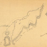
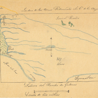
Hand-drawn sketch map of Cañada de los Osos y Pecho y Islae boundaries. Volume 2, page 143.
Date: 1843
-
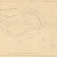
Hand-drawn sketch map of Rio de las Cosumnes al Norte or Omachumnes boundaries. Volume 2, page 22.
Date: 1844
-
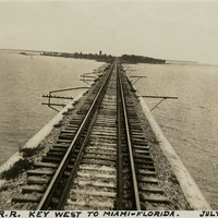
Caption: "P. and O. R.R. Key West to Miami -- Florida. July 2, 1934." View of railroad tracks running over water to an island in the distance. This is likely part of the Overseas Railroad, an extension of the Florida East Coast Railway, built to connect Key West with the Florida mainland.
Date: 7/2/1934
-
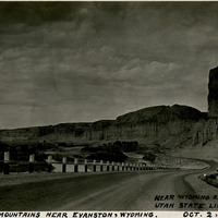
Caption: "Rocky Mountains Near Evanston, Wyoming. Near Wyoming and Utah State Line. Oct. 2, 1934." A narrow road twists into the distance, flanked on one side by bottomland along a river or stream, and on the other by dramatic, steep, rocky bluffs.
Date: 10/2/1934
-
Hand-drawn sketch map of Guaspita, or Sausal Redondo or Santa Elena boundaries. Volume 2, page 30.
Date: 1837
-
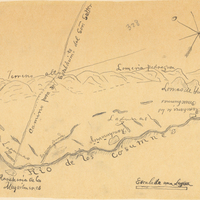
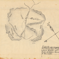
Hand-drawn sketch map of Cañada de los Vaqueros, or Rancho Vasco boundaries. Volume 2, page 115.
Date: 1839
-
Hand-drawn sketch map of Potrero Nuevo or Potrero de San Francisco boundaries. Volume 2, page 54.
Date: 1844